

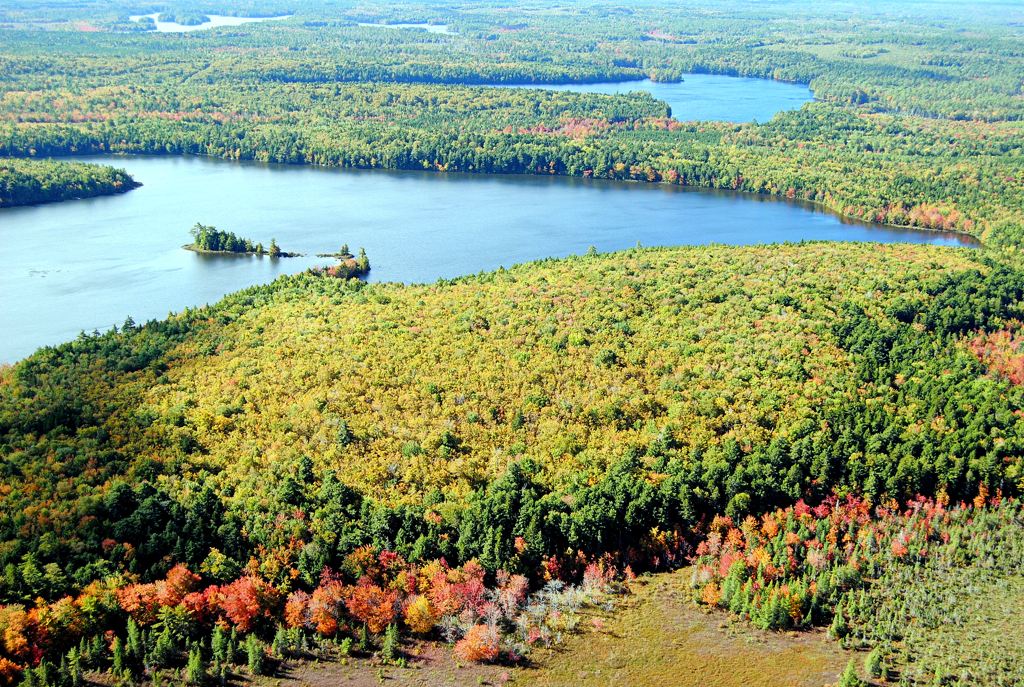
As one of Nova Scotia’s largest wilderness areas, Medway Lakes Wilderness Area is significant for both nature conservation and wilderness recreation.
The wilderness area protects a mix of hardwood and mixed forest hills, conifer flats, wetlands, numerous waterways, and over thirty lakes. The size of this wilderness areas helps sustain wildlife that is sensitive to disturbance and forest fragmentation. Diverse and quality habitats support many species at risk, including Blandings turtle, snapping turtle, American marten, mainland moose, and several bird species. Impressive stands of old sugar maple, yellow birch, white pine, and hemlock are scattered throughout.
Straddling the headwaters of the Medway and Mersey rivers, this wilderness area helps protect water quality for people and aquatic life in two of western Nova Scotia’s largest watersheds. Interconnected and remote lakes, rivers, and streams provide a refuge for native brook trout, which are in significant decline in southwestern Nova Scotia. The Medway River also retains a remnant Atlantic salmon population.
This wilderness area provides good representation of the Fisher Lake Drumlins natural landscape in the provincial protected areas network and improves representation of the South Mountain Rolling Plain natural landscape.
Its proximity to other protected areas supports wildlife movement and ecological connectivity across the landscape.
West Branch River Nature Reserve, which was designated as nature reserve in 2008, is now also within Medway Lakes Wilderness Area.
Medway Lakes offers quality opportunities for recreation and nature tourism in a wilderness setting, including canoeing, camping, angling, hunting, hiking, cross country skiing and nature education. There are no designated campsites but camping is permitted using leave no trace principles.
To help conserve native brook trout, lakes and waterways in the wilderness area are designated as a Special Trout Management Area, which limits the number of trout that can be kept per day (bag limit), with catch-and-release only for brook trout between September 1st and 30th. Details can be found in the provincial “Anglers’ Handbook”, which is updated and published annually.
Canoe routes range from short paddles on individual lakes to challenging white-water conditions or a multi-day traverse of the entire area. Canoe route maps are available from the Municipality of Annapolis County. In addition, Canoe Kayak Nova Scotia (CKNS) has produced a water trail (canoe route) map for the Milford Lakes area, covering the western portion of the wilderness area, and undertakes some maintenance of these routes under terms of an agreement with Nova Scotia Environment and Climate Change.
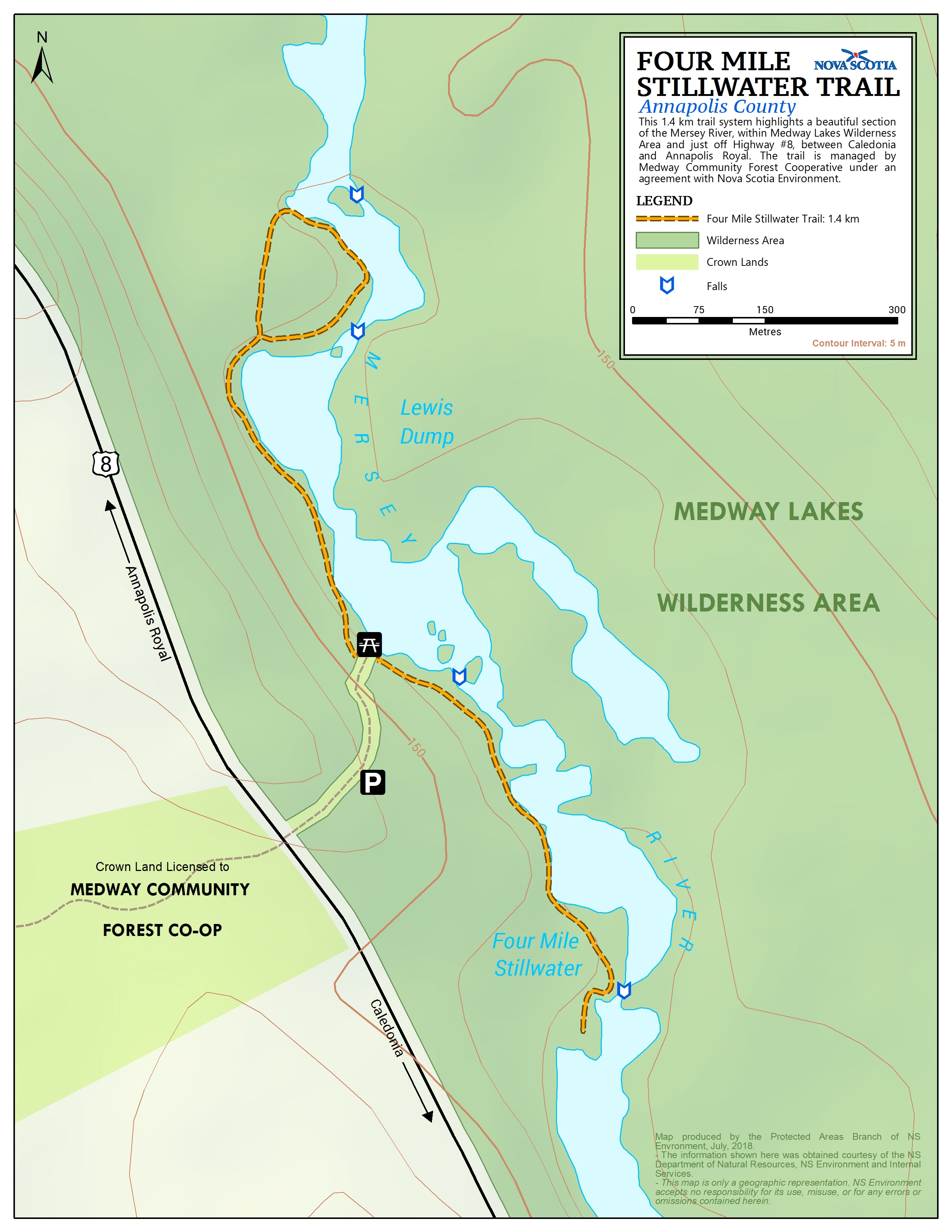
The 1.4 km Four Mile Stillwater Trail provides access to a beautiful section of the Mersey River within Medway Lakes Wilderness Area, just off Highway #8. This hiking trail is managed by Medway Community Forest Cooperative under an agreement with Nova Scotia Environment and Climate Change.
Other trails are designated for snowmobile use (12 km); and all-terrain vehicle, off-road motorcycle and bicycle use (11 km). These trails are managed by the Snowmobilers Association of Nova Scotia (SANS), All-terrain Vehicle Association of Nova Scotia (ATVANS) and Nova Scotia Off Road Riders Association (NSORRA) under agreements with Nova Scotia Environment and Climate Change. Bicycle use is currently permitted on the trails managed by ATVANS and NSORRA.
Several forest access roads provide additional vehicle access:
- West Branch Road passes through the wilderness area in a north-south direction. This road is not part of the wilderness area, allowing vehicle access. It is mostly easily reached via Albany New Road, south of the wilderness area.
- East Branch Road follows the eastern boundary of the wilderness area and also remains open for vehicle use. It too can be reached via Albany New Road.
- Lynch Mill Road, off of Highway #8 north of Milford House, provides vehicle access to the northwestern end of the wilderness area.
- A ~750m road off of Highway #8 provides access to a small parking area at the western end of Eleven Mile Lake. This is a common launching point for canoeing, angling and other activities.
A forest access road also bisects the wilderness area between First Branch Lake and Frog Lake. This road supports forestry access outside the wilderness area as needed. This road is gated at Liverpool River and is not open for general public vehicle use, in part to support management of the Rocky Lake – Allison Lake area as a backcountry destination.
Forest access roads adjacent to the wilderness area are maintained as needed to support forestry operations and may not be passable at times.
Several campsite leases are located within the wilderness area.
Medway Lakes Wilderness Area was designated in 2015 after being acquired as part of the Province’s purchases of Bowater Mersey woodlands in 2007 and 2012. The area was expanded by 430 hectares in 2022. Parts of the wilderness area were logged in the years prior to acquisition, resulting in some young forest stands and plantations scattered through the area. These areas will re-naturalize over time and some sections of old logging road have been decommissioned.