

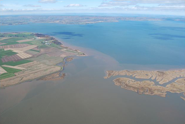
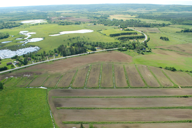
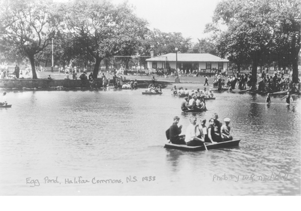
Details on the amount of wetland originally present in Nova Scotia that was lost following European settlement are limited, but losses appear to have been high for some types of wetlands. For example, since the early 1700s, 80% of the salt marshes along the Bay of Fundy and greater than 50% of salt marshes province-wide are estimated to have been lost, mainly to dyking for agriculture. Losses of freshwater wetlands are also thought to be high in our more fertile regions, like the Annapolis Valley and the Northumberland Strait, along the floodplains of the Cornwallis, Annapolis, and Shubenacadie Rivers, as well as near urban centres (Egg Pond, Halifax Commons).
Unfortunately, most loss estimates for Nova Scotia are based on studies with limited analysis, precluding province-wide estimation or assessment of their accuracy. Because there has been little effort to characterize wetland loss systematically throughout the province there is considerable uncertainty about original conditions.
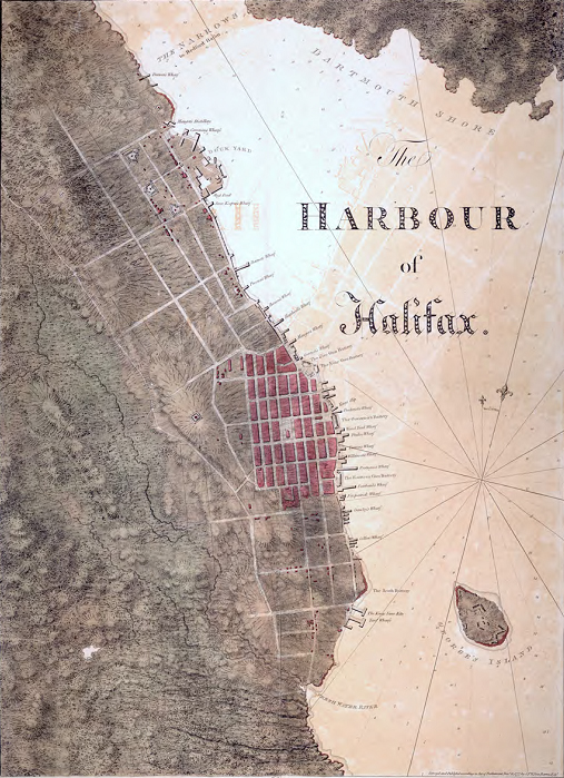
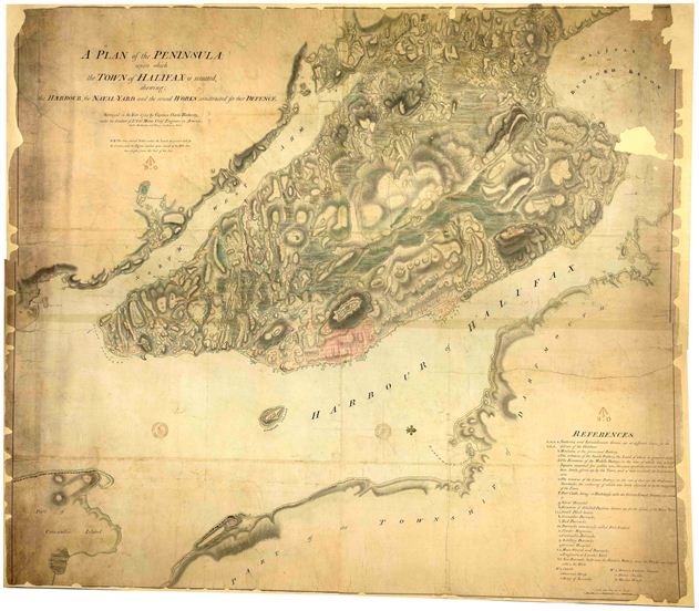
However, a recent study initiated by Dalhousie undergraduates Kailey Hilchey and Becky Parker in 2010 and completed by Mike Reid as part of his Masters in Marine Affairs at Dalhousie University in 2012 provides insight into wetland loss on the Halifax Peninsula. Mike examined a host of maps from the Nova Scotia Public Archives to determine where watercourses and wetlands were originally present on the Peninsula. There were two British military survey maps that Kailey and Becky first uncovered during internships with Nova Scotia Environment that were particularly useful for this purpose. One was drafted by Joseph Frederick Wallet Des Barres that covers the downtown core and a bit beyond in 1779 and another by Captain Charles Blaskowitz covers the entire Halifax Peninsula in great detail in 1784.
In his thesis, Mike Reid notes that along with fellow British Army Officer Samuel Holland, Joseph Frederick Wallet Des Barres was responsible for the most significant land surveys of North America in the eighteenth century. Captain Blaskowitz was part of Des Barres team of surveyors that mapped much of the eastern coast of North America during the late 1700s.
Among all the maps that were examined, the Blaskowitz and Des Barres maps had particularly good detail associated with wetlands and watercourses. Using a geographic information system to analyze the maps, Mike Reid estimated that 18% of the Halifax Peninsula consisted of wetlands in the late 1700s and that there were 78 km of streams flowing across the landscape and into the Northwest Arm or Halifax Harbour. Virtually all of these are now gone. The few wetlands that remain are primarily the small ponds in Point Pleasant Park. This demonstrates that wetland loss in the Halifax core has been extreme and suggests that wetland loss in other urban areas around the province may have been high as well. Only further study of other urban areas will provide definitive answers, but historic maps are available for other regions so similar studies could be completed.
Consequences of Wetlands Loss in Nova Scotia
The loss or degradation of wetlands due to human activities results in a loss or decrease in their ability to provide ecosystem services effectively or support the full suite of ecological functions they normally perform (e.g., controlling flooding and reducing contaminants). GPI Atlantic (Genuine Progress Index for Atlantic Canada) estimates that the remaining salt marshes in Nova Scotia provide over $400 million worth of ecosystem services to Nova Scotia communities each year, including flood and erosion control and infrastructure protection from storm surges. In addition, since wetlands are among the most productive and diverse of all the ecosystems on earth, losing them means reduced biodiversity, a loss of local populations of fish, wildlife, and plants that depend on wetlands for their habitat or food.
Nova Scotia’s wetlands provide billions of dollars worth of benefits in ecosystem services to Nova Scotians annually, according to a GPI Atlantic study on the province’s water resource values. Thus the economic consequences of wetland loss can be substantial. It is becoming apparent to municipalities in other jurisdictions that conserving, constructing, or restoring wetlands may be a more economical option than building water treatment systems to replace the water quality improvement functions that wetlands provide. GPI Atlantic estimates that wetland loss to development in Nova Scotia equates to about $2 billion annually in lost ecological services like water purification, recharging drinking waters, and enhancing fishery productivity.
Some of the largest economic consequences expected to be associated with wetland loss are related to sea-level rise and climate change. The most recent estimates by federal agencies and the Intergovernmental Panel on Climate Change suggest that sea levels in Atlantic Canada will rise at least 1 m over the next century. Higher water levels are expected to result in eroding shorelines, increased flooding during storms and high tides, damage to wharves, buildings, and roads, and contamination of drinking water supplies with salt water. Coastal development and rising seas have already degraded salt marshes and other coastal wetlands, leaving coastlines more vulnerable to large storms.
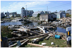 Hurricane Juan damage in Prospect, NS (Environment Canada Photo)
Evidence examined by the Geological Survey of Canada suggests that damage to shorelines, roads, and property from Hurricane Juan in Nova Scotia in 2003 was less in areas with intact barrier beaches and salt marshes than in areas without these natural features. Juan is estimated to have cost Nova Scotia provincial and municipal governments over $100 million, many of the costs associated with damaged coastal infrastructure. Public funds are now routinely spent on flood control in areas where salt marsh has been converted to other land uses, and a number of communities are considering multimillion-dollar seawalls for flood control.